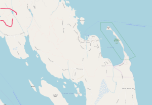
 Inside the red lines is where these two trails are located.
Open Streets Map copyright: https://www.openstreetmap.org/copyright
Blindman’s Bluff and Eagle Ridge Trails
Due to their slightly more-remote access, these two trails are usually very quiet places, not hiked as heavily as other trails such as Chinese Mountains, Morte Lake, and Beeches Mountain trails. But they are worth the extra effort to hike, due to their unique views and terrain.
To get to the start of these two trails drive north from Heriot Bay for about five minutes until you come to North Gowland Harbour Road going off to your left. This is a rough dirt road used daily by logging trucks to carry logs to the Gowland Harbour ocean log-sort. Drive slowly along this dirt road, being watchful for logging trucks using it. Drive it for a few miles until you come to a woodlot road running off up a hill to your right, just before a gate for the log dump road down to the ocean, and a public road turns hard right to become Lieshman Road, going to the private residences of Copper Bluffs.
Follow the woodlot road up its short steep climb to a signposted parking area. Drive past this sign. Drive slowly another kilometer farther on from this sign, but drive slowly as it is slightly rough in spots. You will come to a TRAIL signpost on your left where an old road heads up to the left. Park here (at GPS Point: N 50º 06.769′ , W 125º 16.197′).
Park here, or you can actually push your car up the overgrown old road 50 more meters to a second parking spot, if you don’t mind a few light scratches on your car.
GPS Point: N 50º 06.769′ , W 125º 16.197′
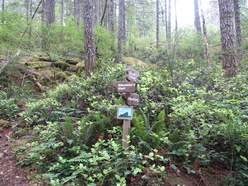
Walk from your car, up the trail a few minutes to this signpost. This trail-head sign also shows a picture of a nesting nighthawk and asks hikers to please carefully control their dogs so as to avoid upsetting the nighthawks which annually nest on the bluffs.
The right trail takes you along Eagle Ridge Trail for 40 minutes to its end on its summit. You then return on that same trail.
The Eagle Ridge Trail begins here at the trail-head, shown above, and goes down to a large swampy marsh then up a ridge to give great views of Discovery Passage and Vancouver Island. The summit is about 30 minutes hiking from your car to the viewpoint on Eagle Ridge and its a steep climb in places. You also could access the Eagle Ridge Trail by driving to the end of Leishman Road at Copper Bluffs, although this access has yet to be re-confirmed for this website. Lieshman Road runs off the far end (west end) of North Gowland Harbour Road.

THE VIEW FROM EAGLE RIDGE SUMMIT @ N 50° 7.109′, W 125° 16.820’, LOOKING WEST OVER DISCOVERY PASSAGE, WHILE A TUG TOWS A LOG RAFT NORTH THROUGH THE RAINY HAZE, NEAR CENTER OF PHOTO.

A CLOSE-UP OF THE TUG AND ITS LOG-RAFT HEADING NORTH ON 29TH MAY. 2018: A CLASSIC British Columbia COASTAL SCENE.
The summit of Eagle Ridge is a very nice spot to have lunch and enjoy watching the vessel traffic in the passage far below.
The Blindman’s Bluff Trail heads left (south) from the signpost shown in the above photo. It climbs up in stages and soon comes to the signpost shown below, offering the loop option. Either way, it takes about 15 minutes of hiking to get you up onto a flat, semi-open basalt plateau. This is an open, desert-like dry rock plateau, sprinkled thinly with trees; a unique terrain type, typical of this region of Quadra Island.

THE SIGNPOST ON THE BLINDMAN’S BLUFF TRAIL, OFFERING THE LOOP OPTION. TAKE THE RIGHT-HAND OPTION HERE AND RETURN VIA THE LOOP, IS THE SUGGESTED CHOICE IF YOU WISH TO HIKE THIS SHORT LOOP.
Once on the plateau, take care to follow the trail closely by looking carefully for the next marker. The markers are comprised of cairns, red square metal trail markers nailed to trees, and occasionally pieces of orange or pink flagging tape on trees. The trail soon arrives at bluffs, then takes you along for a few more minutes to the main lookout point where the trail ends at a large rock cairn, at point at N 50º 6.430′, w 125º 15.975′

THE VIEW OF GOWLAND HARBOUR, THE LOG SORT, AND CAMPBELL RIVER, FROM BLINDMAN’S BLUFF WHERE THE TRAIL ENDS, AND OFFERS YOU THE LOOP OPTION TO RETURN TO YOUR CAR. THIS POINT IS AT THIS LOOKOUT POINT IS AT N 50º 6.430′, w 125º 15.975′
From here you can walk back the way you came, or, head east/northeast along the loop-trail option which takes you back to the main Blindman’s Bluff Trail trail within 10 minutes.
Due to their more-remote access, these two trails are usually very quiet places, not hiked as heavily as other trails such as Chinese Mountains, Morte Lake, and Beeches Mountain trails.
These trails were hiked by admin on 6th September, 2022, and this page was updated on 6th September, 2022.

