The Mount Seymour Trails to Quadra’s highest point, at 2020 feet elevation.

Open Streets Map copyright: https://www.openstreetmap.org/copyright
Double click on the above map to enlarge it to see the location of the two trails which go to Mount Seymour. One trail goes from the Nugedzi Lake Trail and the other trail goes up from Granite Bay Road directly to Mount Seymour.
cellphone reception on this trail is good only above the 1700′ level; along the gently-sloped, open final section of the trail to the summit.
To access the Mount Seymour Trail you drive north from Heriot Bay for six miles to the Granite Bay Road on your left and drive down this dirt road until you see the trail sign up on your left indicating the Mount Seymour Trail. Park beside the road here and begin the climb up to Quadra Island’s highest point. The trail is an old logging road which takes you up a good climb for 30 minutes to a junction where various trails signs nailed to a tree show you your options. This signpost is at: N 50°, 10.479’ W125° 17.565’. Take the trail uphill from the road here. From this signpost you can either climb to the Mount Seymour Summit, or descend to Little Nugedzi Lake and Nugedzi Lake, and from there descend along the trail to the road, then walk a loop back around to Granite Bay Road and to your car, which takes about 25 minutes’ walking along the road.
This page was updated on 19th Feb. 2019.

Looking northwest up Granite Bay Road, with the Mount Seymour Trail sign and a hiker at the trail-head on the left @ N 50°, 10.479’ W125° 17.565’.

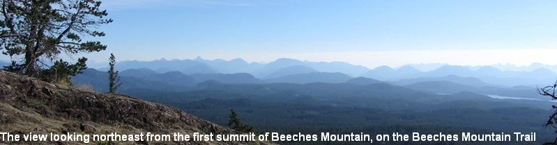
Two hikers and their dog have arrived up at the trails signs on the left indicating the Mount Seymour Trail, and the Nugedzi Lakes Trail connection. The altitude here is 1700′. @ N 50°, 10.479’ W125° 17.565’ From this signpost take the trail up onto the open rock and climb the gentle gradient of the mostly-open plateau for about 25 minutes to the Mount Seymour Summit @ 2020′ at N50, 10.733’W 125, 17.834’, Quadra Island’s highest point.
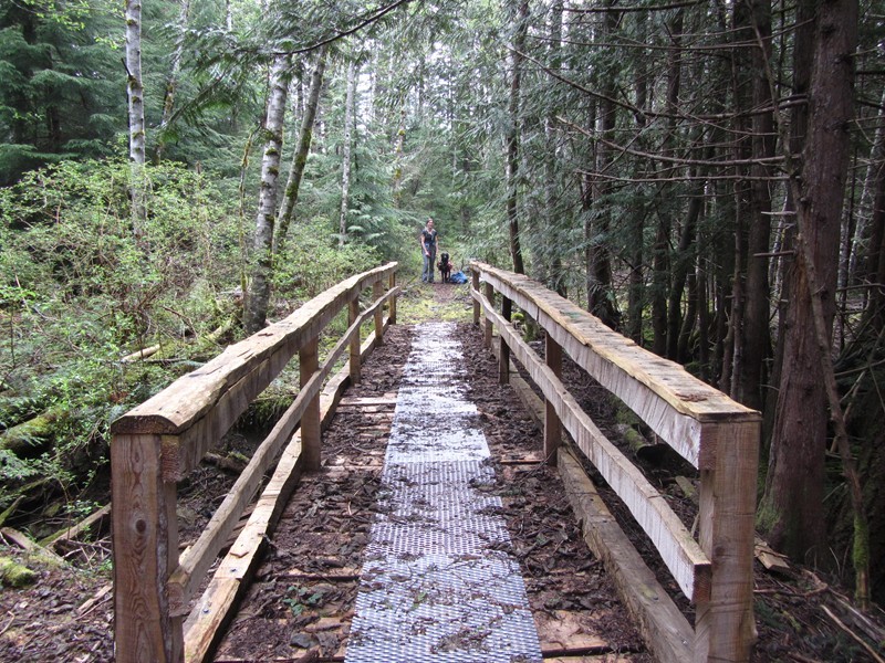
One of the bridges on the Mount Seymour Trail. This strong bridge was made by hand, using chainsaws in 2014.

The cairn on Mount Seymour’s summit.

A German woman rests with her dog on Mount Seymour’s summit, at N50, 10.733’W 125, 17.834’